[ 3] Name on the Register[ 4]
Image
Date listed[ 5]
Location
City or town
Description
1
Clark–Stringham site Upload image June 19, 1973 (#73002154 ) Address restricted[ 6] 42°21′30″N 84°24′30″W / 42.358333°N 84.408333°W / 42.358333; -84.408333 (Clark–Stringham site ) Jackson Also designated 20-JA-37 .
2
Collins Manufacturing – Jackson Automobile Company complex Collins Manufacturing – Jackson Automobile Company complex July 9, 1993 (#93000622 ) 2301 E. Michigan Ave. 42°15′09″N 84°22′32″W / 42.2525°N 84.375556°W / 42.2525; -84.375556 (Collins Manufacturing – Jackson Automobile Company complex ) Jackson Now known as the Commercial Exchange Building
3
Concord Village Historic District Concord Village Historic District July 25, 1996 (#96000810 ) Roughly Hanover St. from Spring to Michigan Sts. and N. Main St. from Railroad to Monroe Sts. 42°10′38″N 84°38′35″W / 42.177222°N 84.643056°W / 42.177222; -84.643056 (Concord Village Historic District ) Concord
4
Denton Road-Sparks Foundation Park Pond Bridge Denton Road-Sparks Foundation Park Pond Bridge January 28, 2000 (#99001676 ) Denton Rd. over Sparks Foundation Park Pond 42°13′38″N 84°25′55″W / 42.227222°N 84.431944°W / 42.227222; -84.431944 (Denton Road-Sparks Foundation Park Pond Bridge ) Jackson
5
First Congregational Church First Congregational Church July 10, 2017 (#100001294 ) 120 N. Jackson St. 42°14′54″N 84°24′32″W / 42.248209°N 84.408783°W / 42.248209; -84.408783 (First Congregational Church ) Jackson
6
Ford Motor Company Brooklyn Plant Ford Motor Company Brooklyn Plant January 12, 2017 (#100000532 ) 221 Mill St. 42°06′35″N 84°14′43″W / 42.109668°N 84.245258°W / 42.109668; -84.245258 (Ford Motor Company Brooklyn Plant ) Brooklyn
7
Grass Lake Public School Grass Lake Public School May 31, 1984 (#84001693 ) 661 E. Michigan Ave. 42°15′06″N 84°12′16″W / 42.251667°N 84.204444°W / 42.251667; -84.204444 (Grass Lake Public School ) Grass Lake
8
Hanover High School Complex Hanover High School Complex December 12, 2012 (#12001030 ) 105 Fairview St. 42°06′07″N 84°32′50″W / 42.1020°N 84.5473°W / 42.1020; -84.5473 (Hanover High School Complex ) Hanover Currently houses the Lee Conklin Antique Reed Organ & History Museum
9
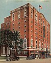
Hayes Hotel Hayes Hotel March 19, 2024 (#100010157 ) 226-234 West Michigan Avenue 42°14′52″N 84°24′37″W / 42.247778°N 84.410278°W / 42.247778; -84.410278 (Hayes Hotel ) Jackson
10
Hebrew Cemetery Hebrew Cemetery June 24, 2009 (#09000474 ) 420 N. West Ave. 42°15′09″N 84°25′24″W / 42.25256°N 84.42343°W / 42.25256; -84.42343 (Hebrew Cemetery ) Jackson Also known as the Temple Beth Israel Cemetery
11
Gordon Hitt Farmstead Gordon Hitt Farmstead July 22, 1994 (#94000743 ) 4561 N. Lake Rd. 42°07′27″N 84°20′04″W / 42.1241°N 84.3345°W / 42.1241; -84.3345 (Gordon Hitt Farmstead ) Columbia Township
12
Jackson District Library Jackson District Library March 10, 1980 (#80001873 ) 244 W. Michigan St. 42°14′53″N 84°24′40″W / 42.248056°N 84.411111°W / 42.248056; -84.411111 (Jackson District Library ) Jackson
13
James M. Jameson Farm James M. Jameson Farm July 15, 1980 (#80001875 ) East of Springport at 10220 N. Parma Rd. 42°22′49″N 84°36′02″W / 42.3802°N 84.6006°W / 42.3802; -84.6006 (James M. Jameson Farm ) Springport
14
Frederick A., Jr. and Caroline Hewett Kennedy Farm Upload image December 21, 2000 (#00000643 ) 8490 Hanover Rd. 42°06′05″N 84°33′56″W / 42.1013°N 84.5656°W / 42.1013; -84.5656 (Frederick A., Jr. and Caroline Hewett Kennedy Farm ) Hanover Township
15
Kentucky Homestead Kentucky Homestead July 1, 1994 (#94000663 ) 3740 Ocean Beach Rd. 42°07′25″N 84°18′13″W / 42.1235°N 84.3035°W / 42.1235; -84.3035 (Kentucky Homestead ) Columbia Township Moved to a county park on the northeast side of Clark Lake. Currently used as the Clark Lake Community Center.[ 7]
16
M-50-Sandstone Creek Bridge M-50-Sandstone Creek Bridge January 14, 2000 (#99001674 ) M-50 over Sandstone Creek42°22′23″N 84°32′42″W / 42.373056°N 84.545°W / 42.373056; -84.545 (M-50-Sandstone Creek Bridge ) Tompkins Township
17
Mann House Mann House October 15, 1970 (#70000273 ) 205 Hanover St. 42°10′40″N 84°38′36″W / 42.1778°N 84.6432°W / 42.1778; -84.6432 (Mann House ) Concord
18
Michigan Central Railroad Jackson Depot Michigan Central Railroad Jackson Depot December 12, 2002 (#02001504 ) 501 E. Michigan Ave., 42°14′52″N 84°23′58″W / 42.247778°N 84.399444°W / 42.247778; -84.399444 (Michigan Central Railroad Jackson Depot ) Jackson
19
Michigan State Prison Michigan State Prison August 10, 1979 (#79001156 ) Armory Court and Cooper St. 42°15′27″N 84°24′21″W / 42.2575°N 84.405833°W / 42.2575; -84.405833 (Michigan State Prison ) Jackson
20
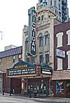
Michigan Theater Michigan Theater May 8, 1980 (#80001874 ) 124 N. Mechanic St. 42°14′53″N 84°24′22″W / 42.248056°N 84.406111°W / 42.248056; -84.406111 (Michigan Theater ) Jackson
21
Mill Street-South Branch Raisin River Bridge Mill Street-South Branch Raisin River Bridge January 14, 2000 (#99001675 ) Mill St. over the South Branch of the Raisin River 42°06′36″N 84°14′44″W / 42.11°N 84.245556°W / 42.11; -84.245556 (Mill Street-South Branch Raisin River Bridge ) Brooklyn
22
Otsego Hotel Otsego Hotel April 20, 2015 (#15000158 ) 102–106 Francis St. 42°14′50″N 84°24′16″W / 42.247174°N 84.404413°W / 42.247174; -84.404413 (Otsego Hotel ) Jackson
23
Paddock-Hubbard House Paddock-Hubbard House December 9, 1994 (#94001429 ) 317 Hanover St. 42°10′40″N 84°38′25″W / 42.1779°N 84.6403°W / 42.1779; -84.6403 (Paddock-Hubbard House ) Concord
24
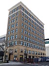
Peoples National Bank Building Peoples National Bank Building December 2, 2014 (#14000977 ) 101 E. Michigan Ave. 42°14′50″N 84°24′21″W / 42.2473°N 84.4057°W / 42.2473; -84.4057 (Peoples National Bank Building ) Jackson
25
Hugh H. Richard House Hugh H. Richard House December 2, 1993 (#93001352 ) 505 Wildwood Ave. 42°14′53″N 84°25′01″W / 42.248056°N 84.416944°W / 42.248056; -84.416944 (Hugh H. Richard House ) Jackson
26
Ella Sharp House Ella Sharp House August 25, 1972 (#72000622 ) 3225 4th St. 42°12′54″N 84°25′04″W / 42.2149°N 84.4179°W / 42.2149; -84.4179 (Ella Sharp House ) Jackson Now the Ella Sharp Museum
27
Siebold Farm/Ruehle (Realy) Farm Siebold Farm/Ruehle (Realy) Farm March 30, 1973 (#73000952 ) 9998 Waterloo-Munith Rd. 42°22′46″N 84°10′48″W / 42.379444°N 84.18°W / 42.379444; -84.18 (Siebold Farm/Ruehle (Realy) Farm ) Waterloo Township Now the Waterloo Farm Museum
28
Stone Post Office Stone Post Office March 16, 1972 (#72000623 ) Rear of 125 N. Jackson St. 42°14′53″N 84°24′30″W / 42.24805°N 84.4083333°W / 42.24805; -84.4083333 (Stone Post Office ) Jackson
29
Henry and Aurora (Walker) Vinkle House Upload image July 31, 2017 (#100001391 ) 371 W. Michigan Ave. 42°14′56″N 84°13′07″W / 42.248983°N 84.2187°W / 42.248983; -84.2187 (Henry and Aurora (Walker) Vinkle House ) Grass Lake Also known as the Coe House
30
Andrew Wilcox House Andrew Wilcox House December 14, 1987 (#87002138 ) 231 E. High St. 42°13′58″N 84°23′54″W / 42.2328°N 84.3984°W / 42.2328; -84.3984 (Andrew Wilcox House ) Jackson


